 Humanities and arts
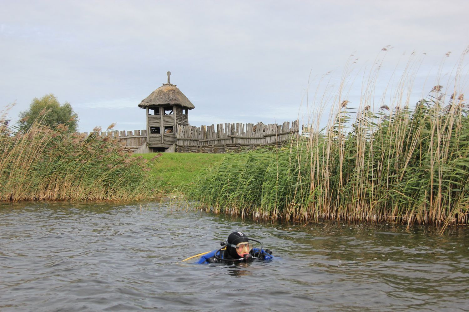
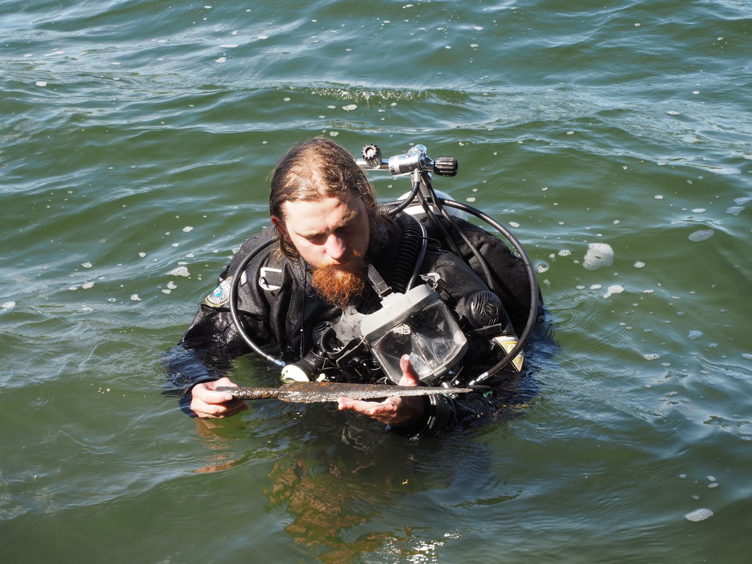
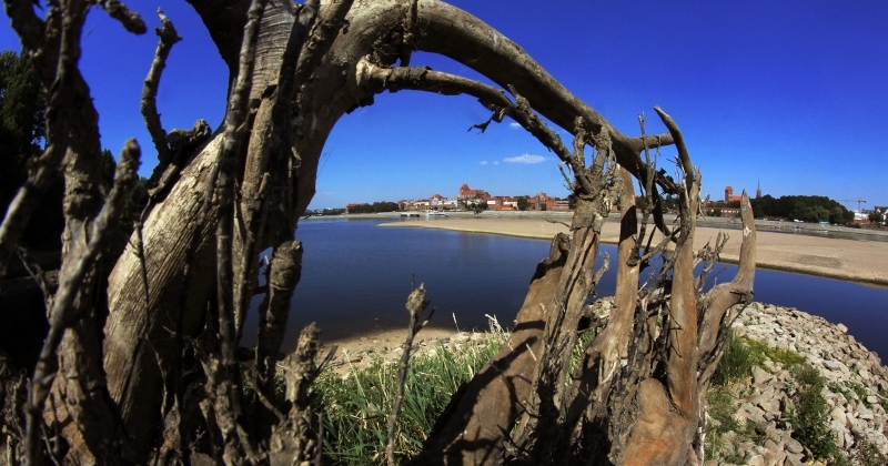
Explorers of underwater secrets


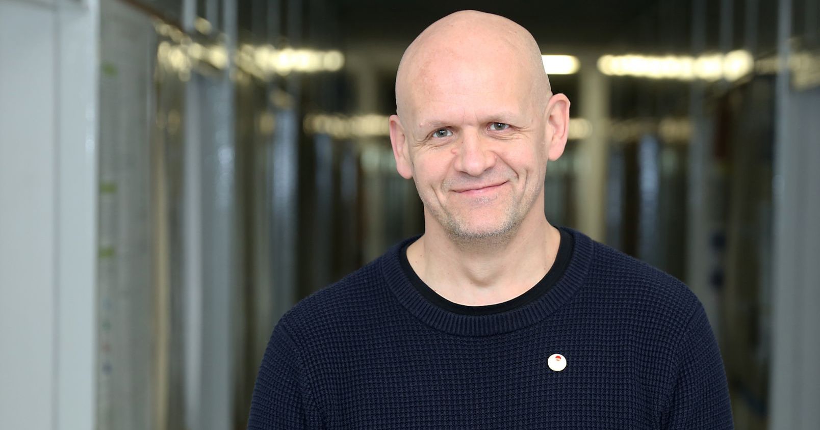
Fishermen's stories about piles tearing nets, treasure hunters' records from the turn of the 19th and 20th c., reports from diving clubs, as well as going down to the bottom of the lake with a mass of equipment - the course of underwater archaeological investigations is told by dr habil. Andrzej Pydyn, NCU Prof.
Despite the pandemic and the restrictions associated with it, underwater archaeologists from Toruń consider this season a successful one. They have completed the EU funded research in the port of Puck, continued their research on the lake around Ostrów Lednicki and started a project funded by the Ministry of Culture and National Heritage to broaden their knowledge of the Biskupin-type settlements and define their range. – It was a very successful season in Ostrów Lednicki, despite the fact that there were no students, because such were the guidelines of the Rector's authorities and no foreign partners, although this time it was supposed to be strongly international research, says Prof. Andrzej Pydyn, from the Centre for Underwater Archaeology and the Institute of Archaeology. – Unfortunately, COVID-19 has effectively limited our activity at international conferences and meetings and has thwarted a joint project with the UNESCO International Centre for Underwater Archaeology in Zadar in Croatia.
The duration of the season in underwater archaeology is not strictly defined, but there are several factors limiting investigative activity. Firstly, it is the budget and funding of projects. – I have the impression that in underwater archaeology, being a manager is as important as being an archaeologist and a diver, says Professor Pydyn. - This is not cheap research because of its uniqueness, involving a large number of equipment requiring technical maintenance, supervision and regular servicing.
Secondly, we need to remember the structure of the academic year, which in a way imposes deadlines for long-term research projects, and thirdly, the weather. - Once, when diving equipment was much simpler, we were more exposed to temperature conditions and these were the ones that determined how long we could stay underwater,' explains the archaeologist from Toruń. At the moment, the equipment is much better, thus, we carried out the project in Puck, mainly in early spring or late autumn. Last year, research continued there even in the first days of December. This was due to the seasonality of water transparency in the Polish climatic conditions.
The waters of the Baltic, like those of inland waters, have the best transparency in early spring or late autumn, while in summer, visibility is often clearly limited due to vegetation and plankton development.
The start of archaeological research is preceded not only by the organisation of funds, groups of students and choosing the right time of year. Scientists do not sit at the map and do not point their finger at the lakes they are going to visit in a week or a month. Each of them begins a query combining various threads. First, the researchers look for reports from fishermen who have pulled out an object, or for example, that they have hooked a fishing net on some underwater piles. Information is verified against data coming from diving clubs, especially those that were established at the beginning of diving in Poland at the turn of the 1950s and 1960s.
Sometimes these records appear in different places, they are very inconsistent, explains Professor Pydyn - However, this is a clue of some sort. We check what was happening around the lake. If there is a documented prehistoric, early-medieval settlement, this is the starting point. In the case of lakes, we have a terrain form, i.e., if there is a stronghold on the island, then probably something happened around the island as well.
In the Warmia, Masuria and partly the Pomerania region, archaeologists may also use information collected by enthusiasts of the antiquity from the turn of the 19th and 20th centuries. It was then that the extensive investigations of water bodies, especially inland ones, were carried out. That was due to palafites found in Alpine lakes, i.e., sites identified then as structures on piles. At the end of the 19th century, after the correction of water levels for flood control purposes and the acquisition of green areas, a huge number of sites with perfectly preserved historical objects appeared. Besides, there was talk of "palafitic fever" in Europe. The search for historical objects in the lakes spread from Scotland to East Prussia.
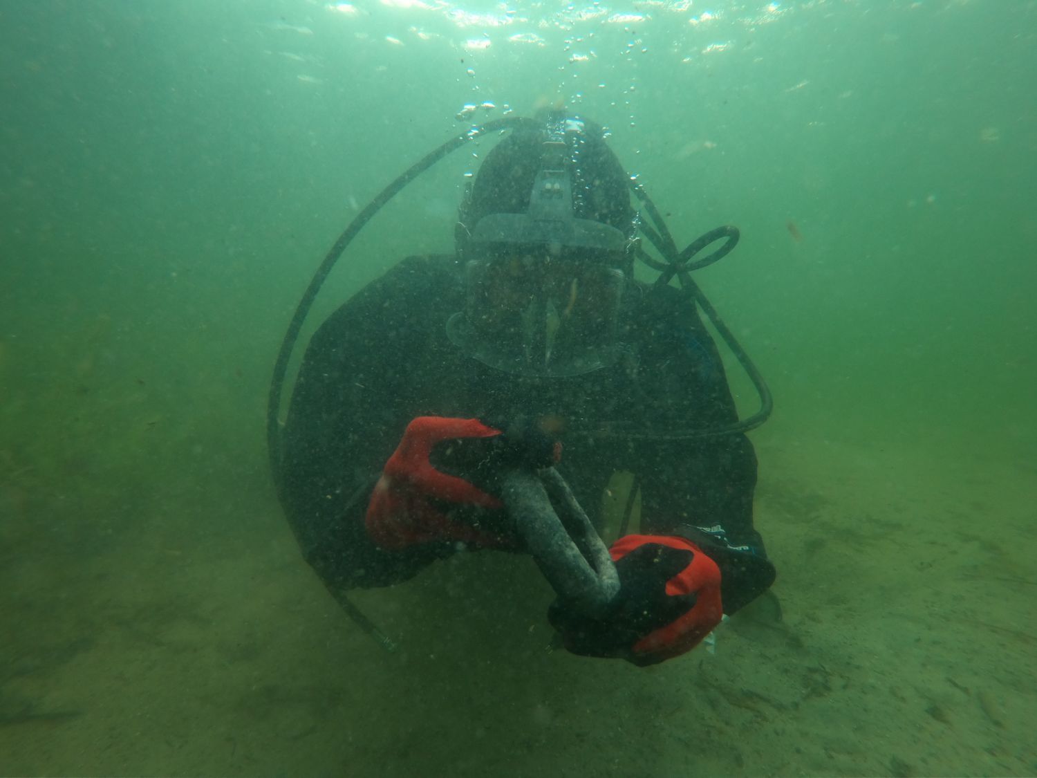
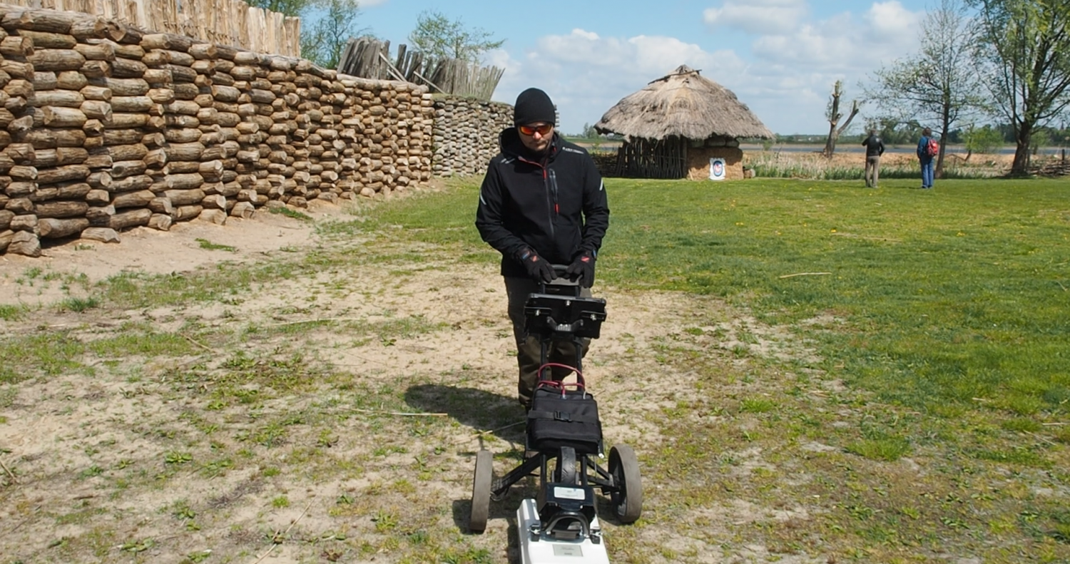
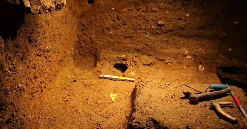
Archaeologists are trying to make the search as complete as possible. Apart from these methods of detection, since the beginning of archaeological investigations they have been using so-called underwater prospecting. After a detailed briefing, underwater archaeologists are assigned areas for underwater inspection. Most often these areas are closer to the shore, because one can expect some traces of human activity there. If archaeologists find anything, they will mark the site with a buoy. Until a dozen or so years ago, scientists had trouble documenting these initial discoveries, putting them on maps, they did so rather roughly. Nowadays, they use modern surveying equipment, and thanks to GPS with an RTK correction, they are able to trace the place they are looking for with an accuracy of one centimetre. They may return to artefacts hidden under water many times. Modern technologies have significantly enhanced the quality of underwater prospectuses. They use primarily hydroacoustic devices, ranging from a simple probe that anyone can buy, to multi-beam probes that allow the shape of the bottom to be reconstructed very accurately, and the more accurately, the more archaeologists can determine what is under water. The second device they use is a bottom sediment profiler. Its operation is also based on acoustic waves, only at a different frequency. This frequency penetrates the bottom and allows the anomalies there to be found. Unfortunately, this image is not as accurate. Underwater archaeologists know that there is an anomaly in a given place, but they are not able to determine whether they have found an archaeological artifact or a large stone. All kinds of magnetic surveys and devices are also developing, from metal detectors, often used by illegal searchers, to large-scale magnetic surveys showing anomalies in the Earth's magnetic field,' explains Professor Pydyn. - This shows that there are objects that disturb the magnetic field. These technologies were not developed especially for archaeology, they came to it through the back door. They were created for commercial research at sea. It appears that with respect to lakes, everything is smaller, shallower and research should be easier. It turns out that the use of these technologies in shallow water bodies is much more difficult, because this technology was not invented to work in shallow waters. I have no doubt, however, that these are tools that will increasingly dominate archaeology and underwater archaeology, and that their operation will become another skill required of researchers.
I think that the argument that we will no longer find anything new in Ostrów Lednicki, because research has been going on there for many years, is misleading,' says the archaeologist from Toruń.
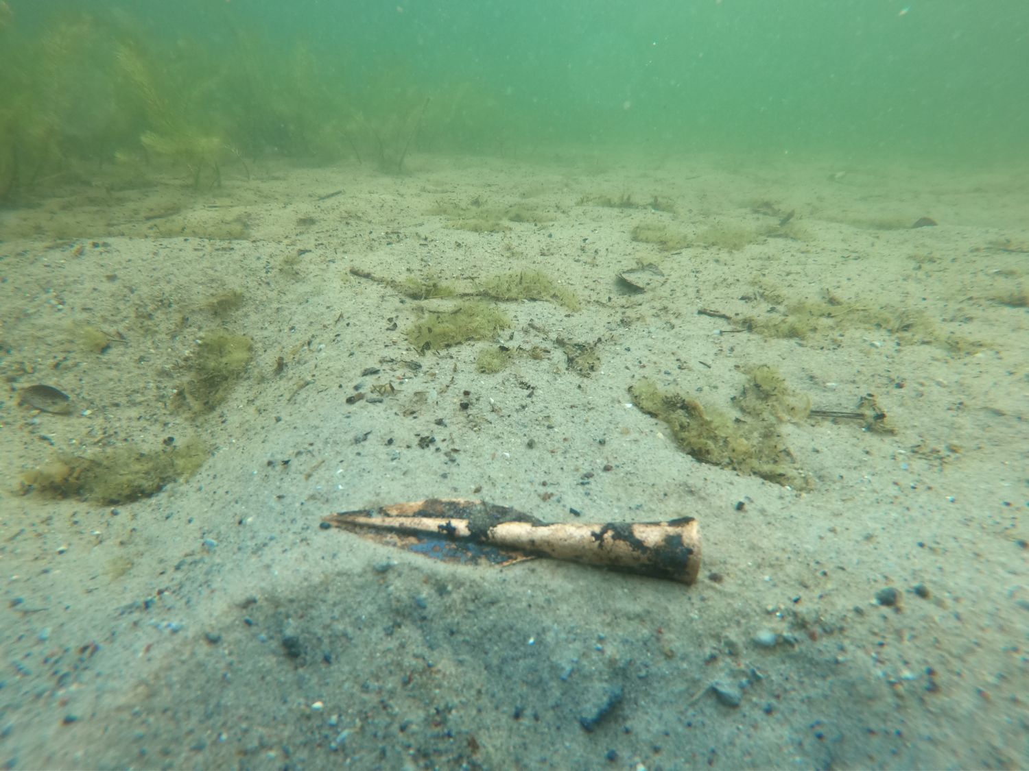
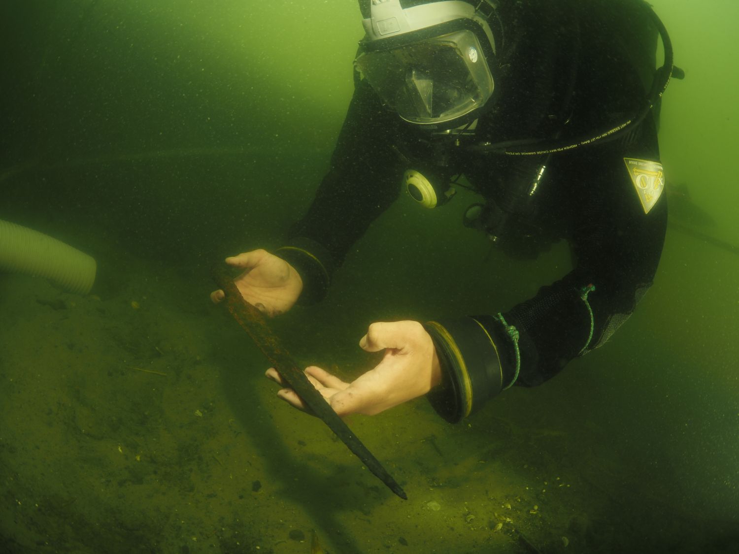
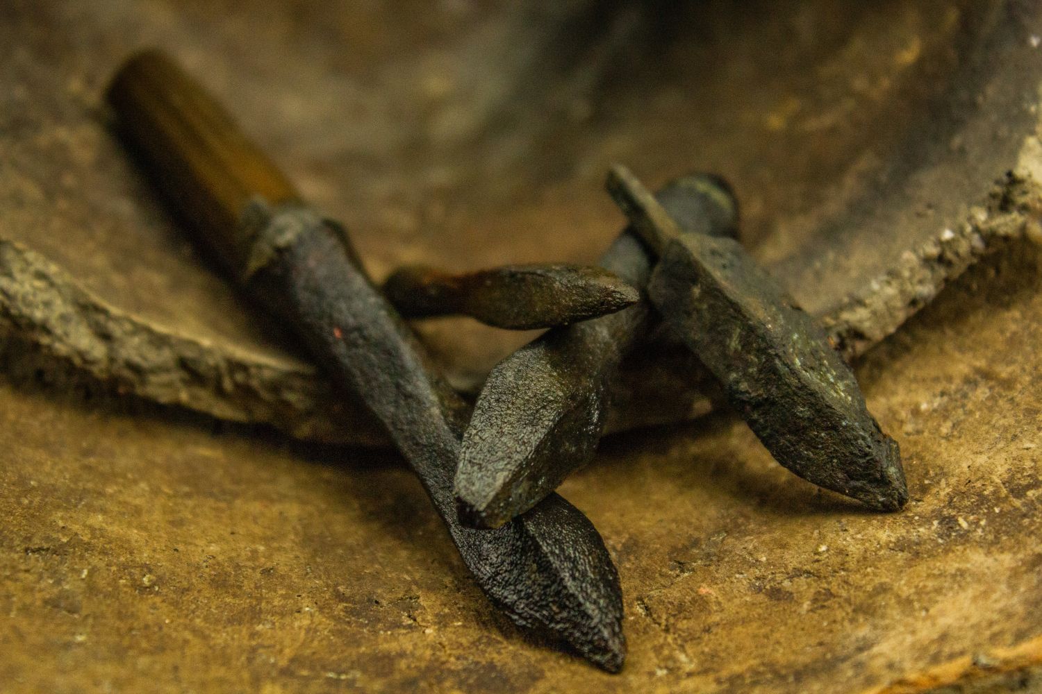
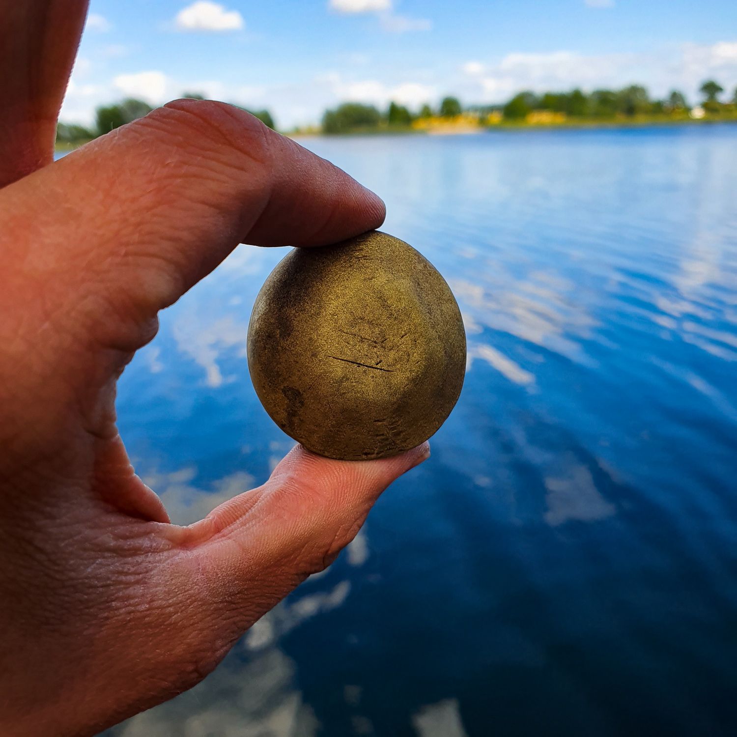
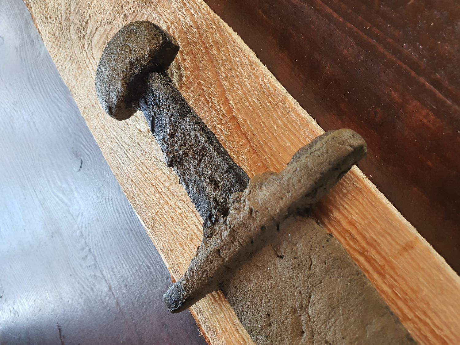
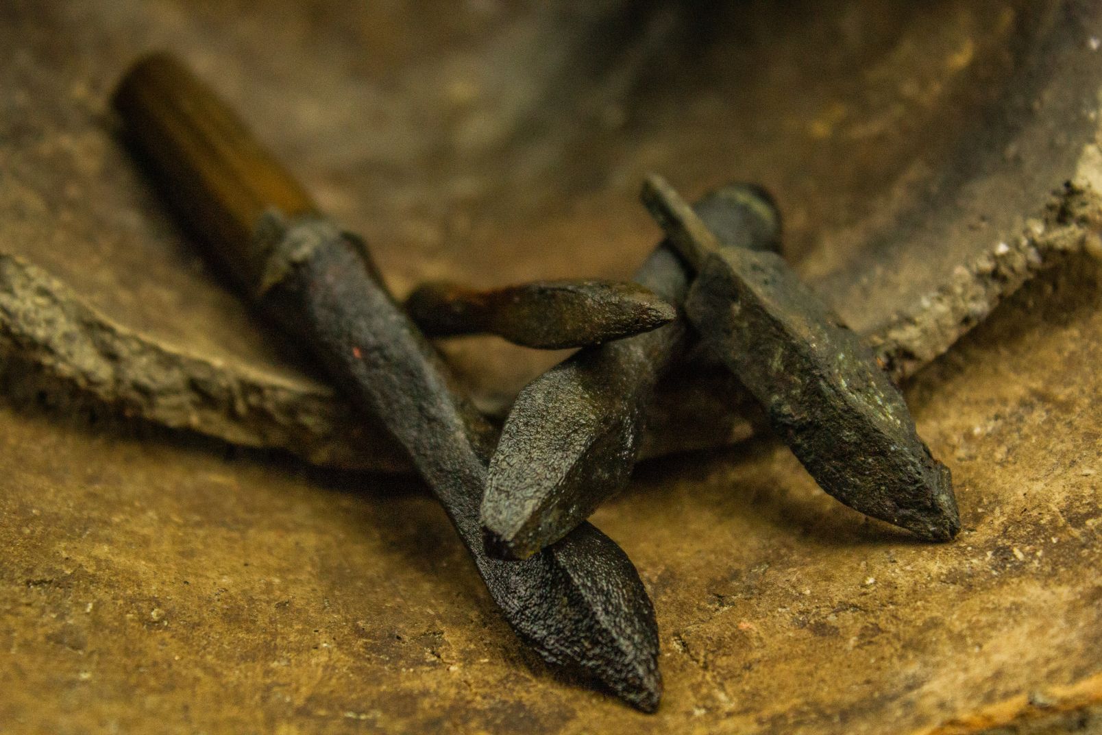
Thanks to their own skills and the use of modern technology, this year researchers managed to find 10th-century militaria, fragments of ceramics and animal bones, as well as remnants of shore fortifications from the reign of Mieszko I in the Ostrów Lednicki area. – I think that the argument that we will no longer find anything new in Ostrów Lednicki, because research has been going on there for many years, is misleading, says the archaeologist from Toruń. - Ostrów deserves a very comprehensive project, not only concerning underwater exploration but also land and environmental investigations. The previous ones were carried out 20 years ago, but our knowledge has changed significantly over that time. Ostrów deserves this, above all, because of its historical value and potential.
Mateusz Popek
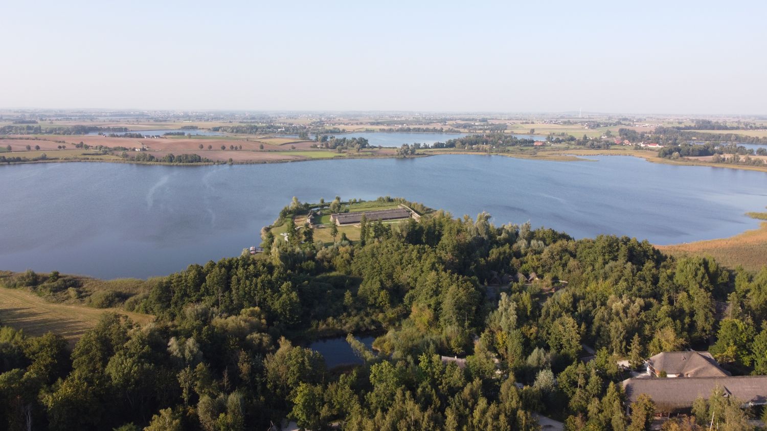
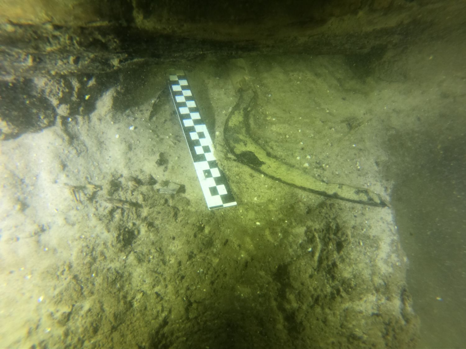
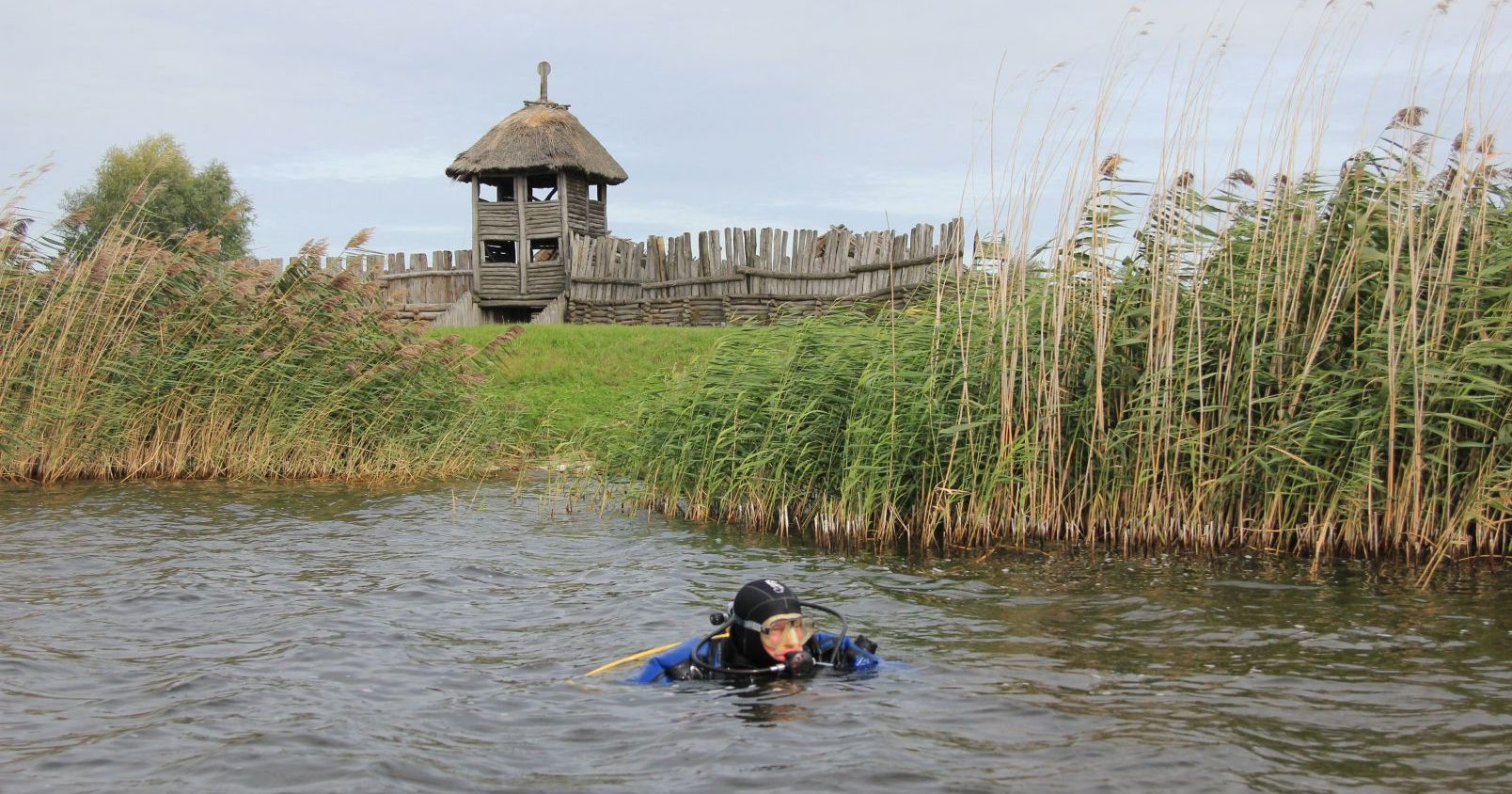
This unique archaeological site from the early Middle Ages is connected with the history of the early Piast state. The first archaeological discoveries in the waters of the lakes surrounding the island on which the stronghold stood come from the turn of the 1950s and 1960s. They were carried out by members of the diving club in Poznań. Archaeologists from the Nicolaus Copernicus University came to Ostrów in 1982. The investigations were initially performed by dr Gerard Wilke and Prof. dr habil. Andrzej Kola, and then by generations of archaeologists. They have lasted for almost 40 years, but if we look at the two bridges discovered at that time, it turns out that the level of their excavation reaches 10 maybe 12%. But such is the specificity of archaeological research that it is not necessarily necessary to unearth 100% of the site.
This year, scientists came across another bridge crossing and everything seems to indicate that there were two bridge crossings of different chronology linking the neighbouring island of Ledniczka to the west coast. - A few days ago, I received the results of a radio-carbon test confirming a two-phase interpretation of this assumption,' informs Prof. Pydyn. - This changes our interpretations of the context of Ostrów Lednicki, it seems that the settlement complex functioning there was much more complex than we thought and I think that we still have a number of interesting discoveries ahead of us, not only related to the bridge crossing to Ledniczka, but also to the bridges studied earlier.
The archeologist believes that there are many unexplained objects, such as very complex structures in the central part of the Gniezno bridge. Despite taking a number of dendrochronological tests from both bridges, the picture of their functioning is not complete, and the dates that the researchers obtained this season from the coastal fortifications next to Ostrów Lednicki itself show that after the invasion of Brzetysław in 1038, a lot was still going on there. It must have been rebuilt, which is confirmed by the historical material, especially ceramics. However, it is commonly believed that the importance of the centre clearly decreased.
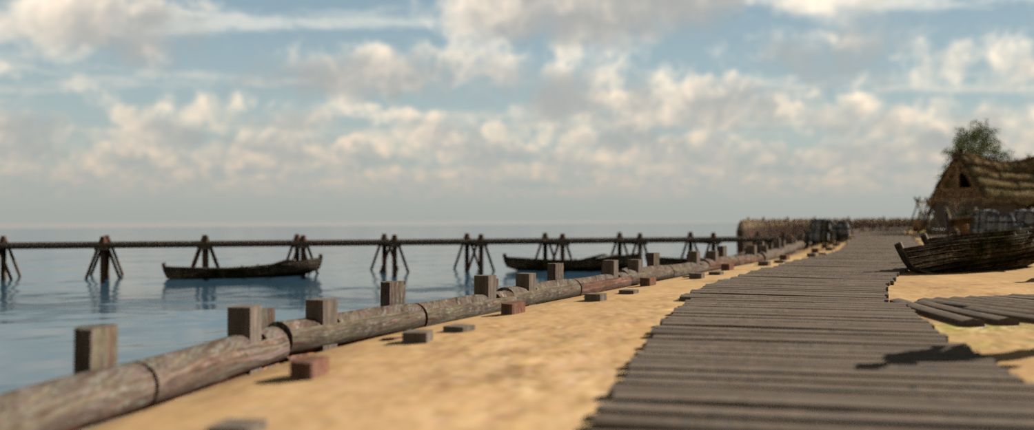
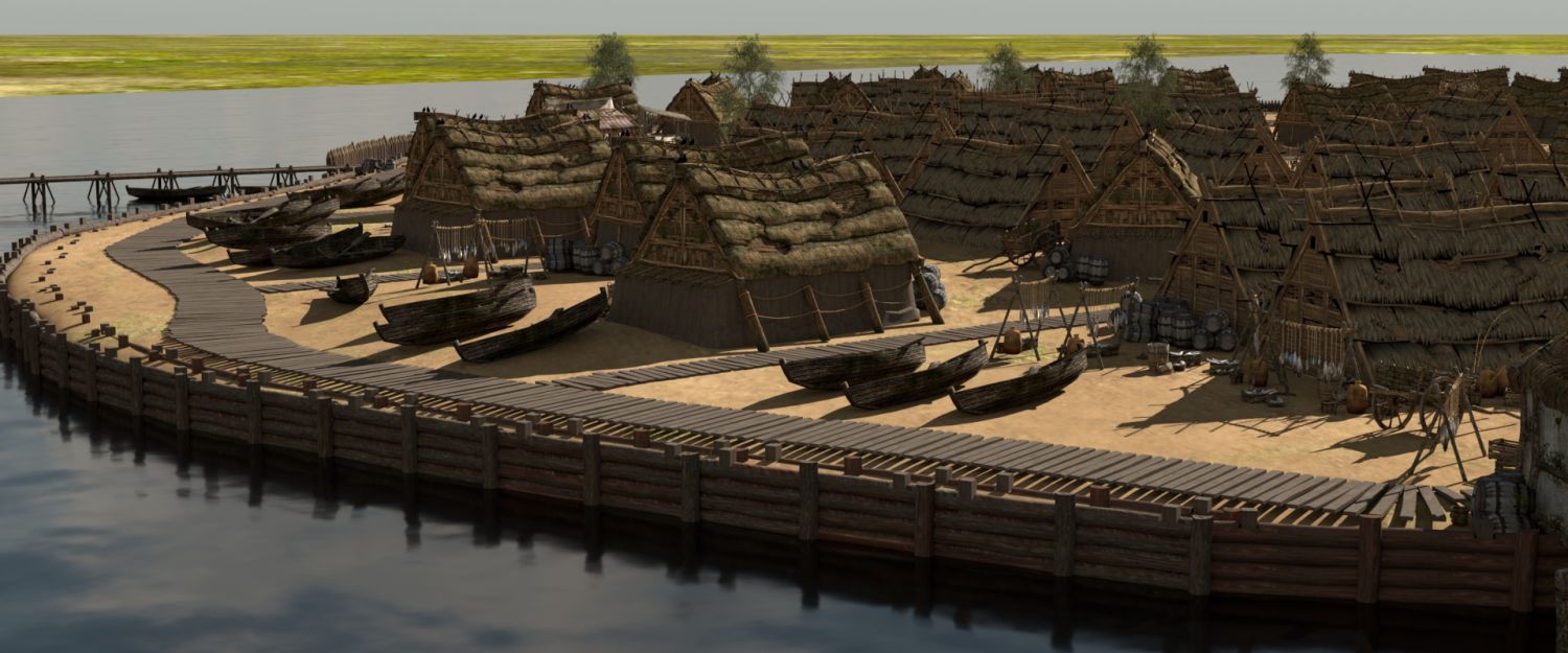
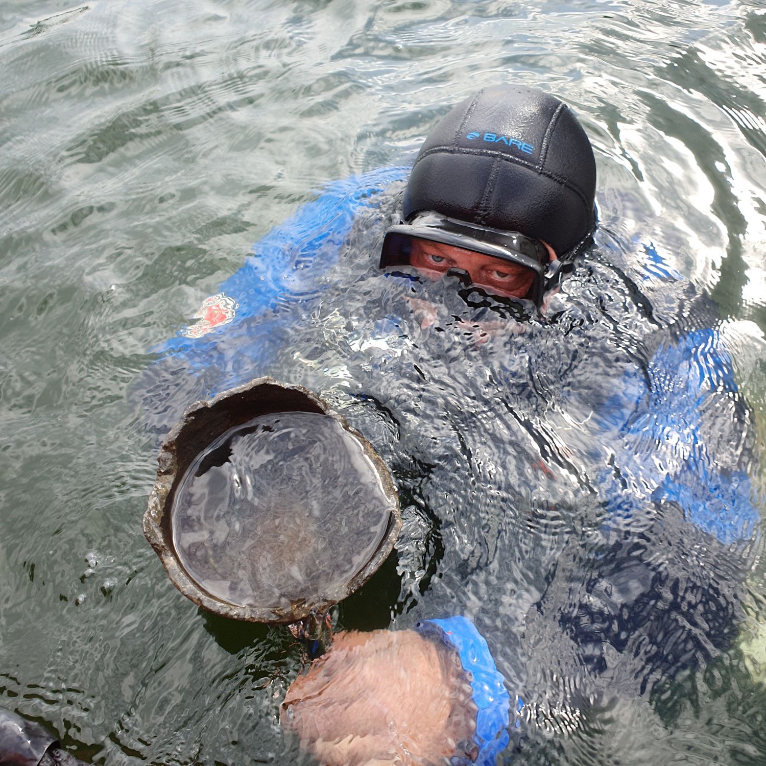
The shallow bay near Puck has been used since ancient times. The port itself appeared and began to operate when it entered the sphere of influence of the early-Piast state. It has three distinct phases of development, and its end seems to be the establishment of the town of Puck in its current location and the subsequent Teutonic influence. A dozen or so hectares of structural objects, wooden piles and relatively shallow water (up to three metres deep) have been waiting for archaeologists there.
Unfortunately, the central part of the port was destroyed during the construction of the canal to the Mechanical Plant. - This site is exceptionally interesting, with great potential, but it requires the supervision of a conservator, because the layers in which the archaeology is located are systematically destroyed mainly due to ice floes and waving - says Prof. Pydyn - We have managed to collect photographs from several decades and I have seen this site disappear.
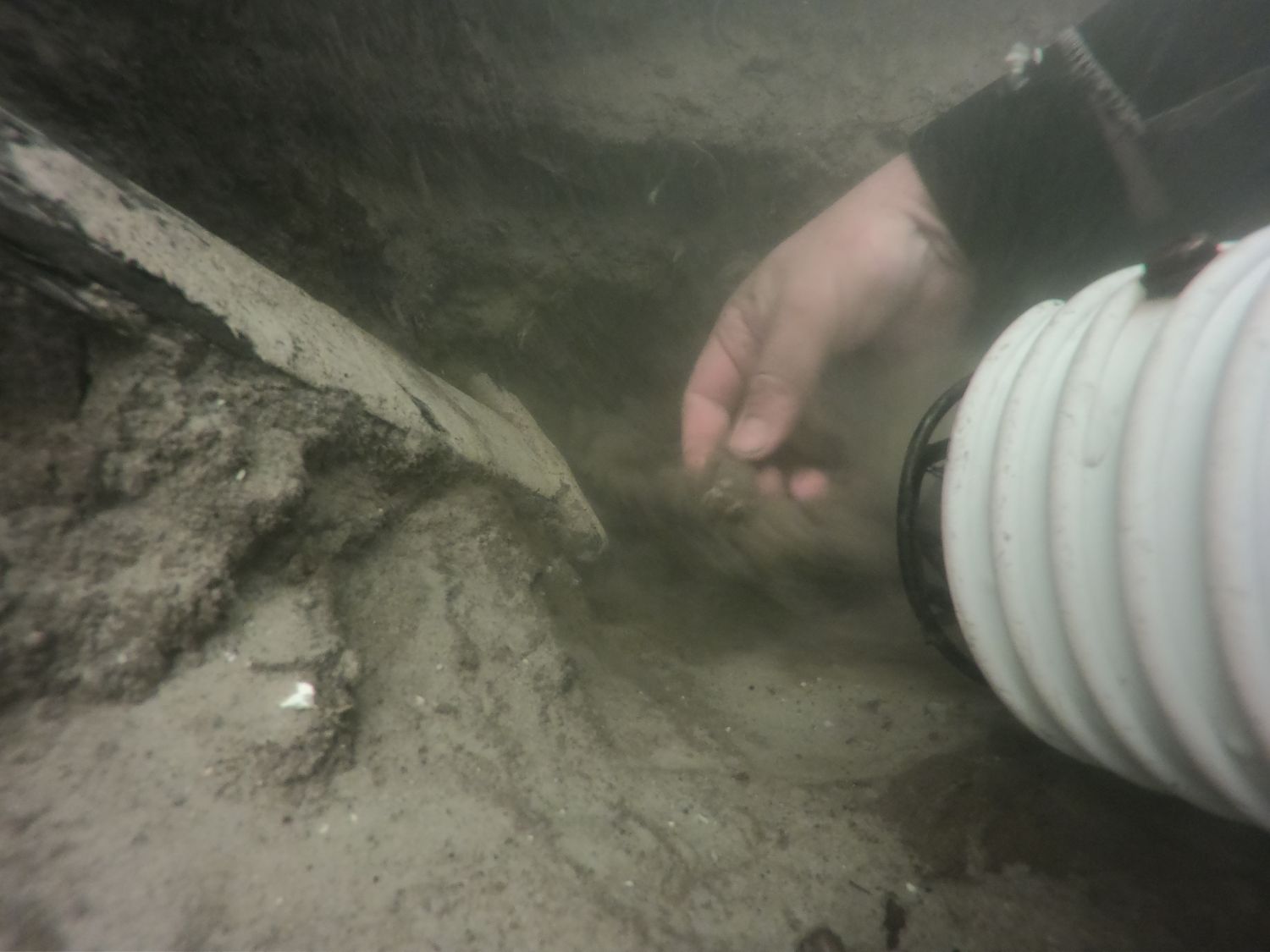
Archaeologists do not pick up everything they find below the surface. Much depends on the nature of the investigation. - People associate extracting objects from the lake with treasure hunting in a model from the turn of the 19th and 20th c. or with a link to a film I got a few days ago, in which a group of explorers throws a neodymium magnet and pulls out everything that attaches to it, including archaeological objects,' says the archeologist.
- If we make a prospection comparable to surface research, that is to say, we want to know statistically that we have some archaeological objects from such an area or stretch of land, including usually scattered material, then we collect it. It is then analysed in formal and chronological terms. However, if we work at a site such as Ostrów Lednicki or the port of Puck, we are not able to extract everything, even in a technical sense. We remove the silt and all the structural elements remain in the water.
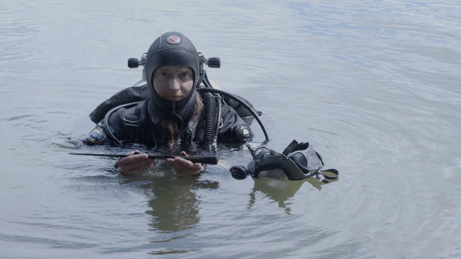
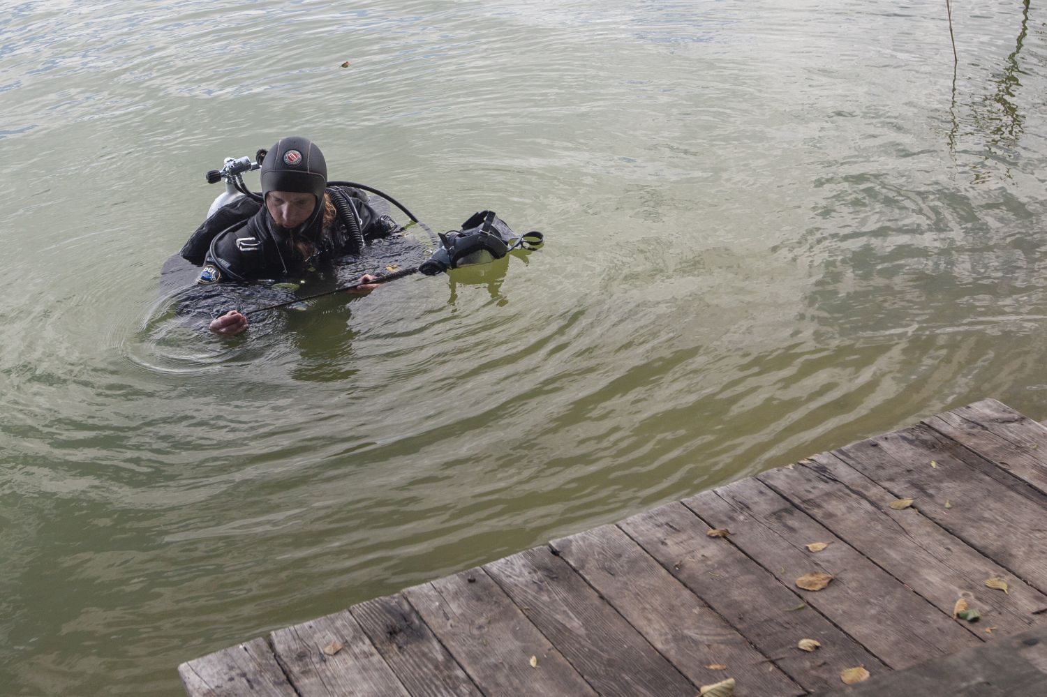
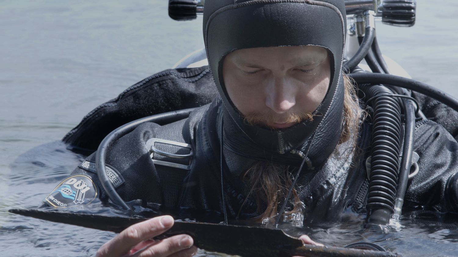
As far as movable artifacts are concerned, divers rather try to pick them up, because they are still uncovered during the exploration. Then they can be steadily assessed on the surface. Besides, the diving method has also changed. Researchers more and more often go underwater in full face masks, which are safer and provide communication with the surface. If they are not sure of something, they can discuss their doubts with the supervisor. You can also film the site, and after getting out of the water, you can study the object, discuss the ambiguities and come back to it. Cameras that provide a fibre-optic image to the surface in real time will be another element that can speed up the decision-making process.
There is also no need to pull everything up to the surface, because researchers are unable to examine the entire port of Puck or the entire length of the bridges to Ostrów Lednicki. They have to choose areas that respond at least partially to the research questions they formulate. They can also go back to places they have already documented. Three seasons ago they introduced a new method of documentation, so-called photogrammetry. It allows tens of thousands of photos taken underwater to create 3D models. They are very accurate, reflect reality, and are certainly more precise than the drawings that archaeologists made a few years ago. Therefore, in the future, researchers from the Nicolaus Copernicus University would like to go back to the areas already explored, where elements of wooden structures are visible, and they would like to document them in this way.
Next season, archaeologists from Toruń are planning to continue research in Ostrów Lednicki. - We are going to visit Puck again, because there are a few questions left that we have not found answers to, even though this project has already formally ended,' says Professor Pydyn. - We are in the process of researching the Biskupin-type settlements. It is a two-year project, so we will certainly return to the lakes in the spring, especially as there is a huge difference in water transparency between spring and autumn in Pałuki. I hope that the pandemic situation will allow us to continue our international cooperation, especially the projects in Croatia and most probably in Montenegro, if we can solve some organisational issues.