 Humanities and arts
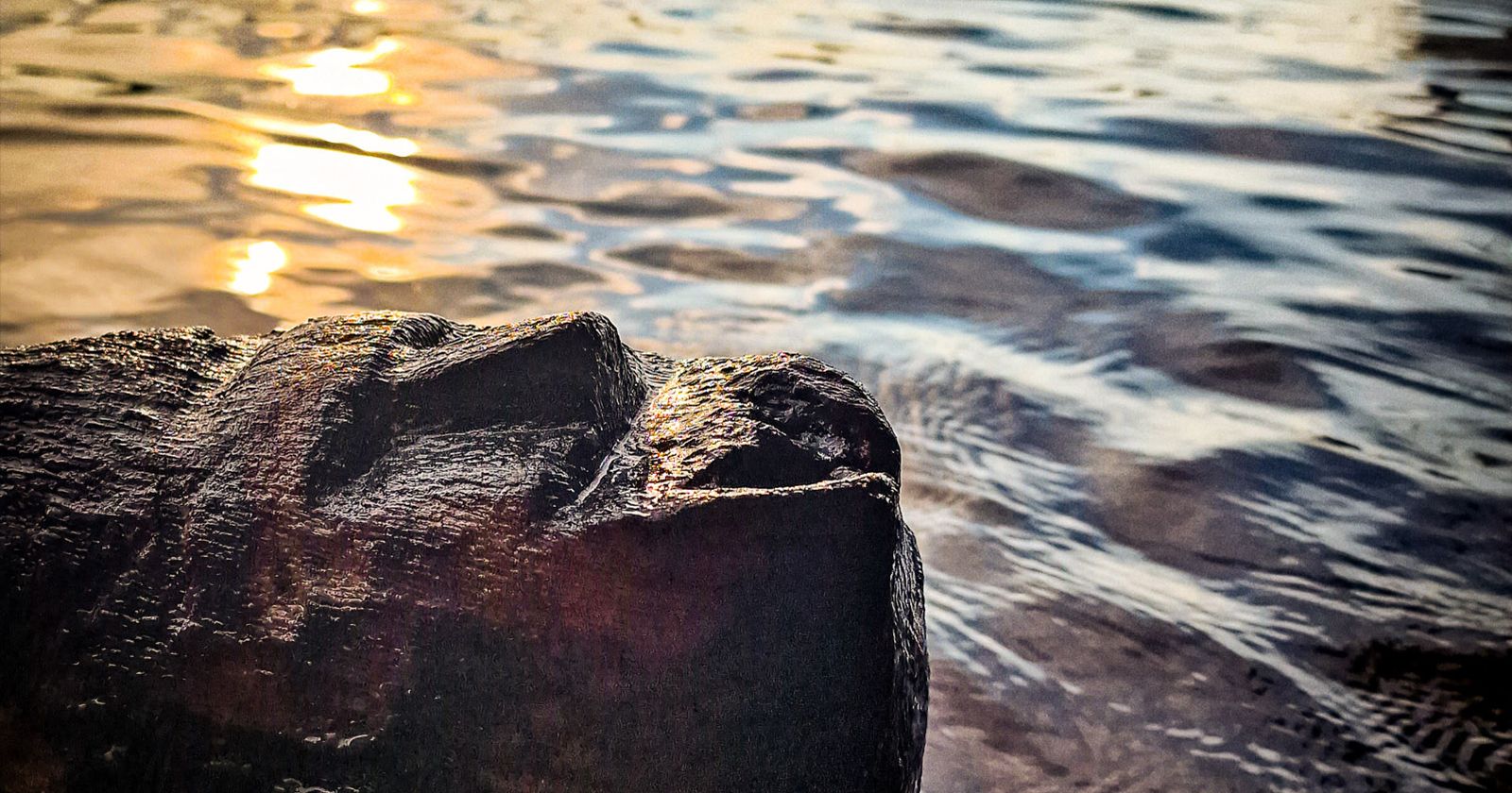
A new era of underwater exploration


The Centre for Underwater Archaeology at the Nicolaus Copernicus University has acquired one of the most modern devices used in aquatic environment research – the Multibeam Echo Sounder (MBES) system, i.e. a multibeam probe.
This technology, which has been a fundamental tool in hydrography and oceanography for years, opens up new possibilities for the NCU Centre for Underwater Archaeology to explore, document and analyse cultural heritage hidden underwater. Its purchase was made possible thanks to the support of the IDUB (Excellence Initiative – Research University programme).
This is an investment not only in technology, but above all in the quality and future of our research. Thanks to it, the Centre for Underwater Archaeology can become a leader among research centres that conduct world-class research in a modern, efficient and interdisciplinary manner," emphasises dr habil. Andrzej Pydyn, NCU Prof at the NCU Department of Prehistory at the Institute of Archaeology and Director of the Centre for Underwater Archaeology.
What is a multibeam echosounder?
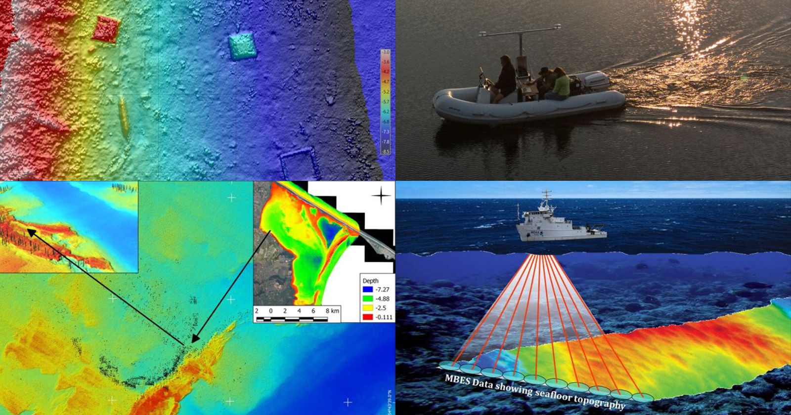
It is a type of sonar that emits hundreds of narrow acoustic beams that fan out from the transmitter, scanning the bottom with great precision. By measuring the return time of each of these beams and coupling with D-GPS, the device creates an extremely accurate 3D model of the bottom of the water body. MBES also records backscatter, i.e. the intensity of sound wave reflection from the bottom surface, which allows for the analysis of sediment types and their structure.
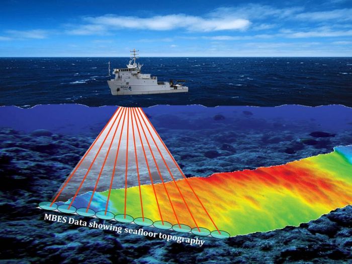
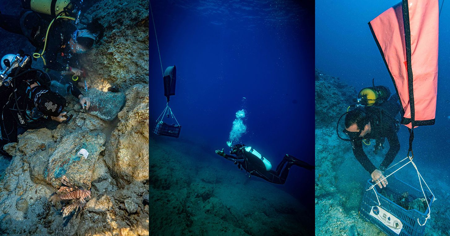
"This system not only allows us to see what the seabed looks like, but also to better understand what it consists of and how it has changed over time," says dr habil. Andrzej Pydyn, NCU Prof at the NCU Department of Prehistory at the Institute of Archaeology. “For us, underwater archaeologists, this is a revolutionary tool. Traditionally, underwater research involved long hours of diving, slow searching of small sections of the seabed and a great deal of uncertainty about what might lie beneath the surface. MBES allows us to see vast areas of water bodies in a very short time, indicating with great accuracy the locations of interesting structures, wrecks, traces of human activity or environmental changes. Instead of looking for a needle in a haystack, we can now precisely target specific points, which will then be the subject of detailed diving research.
Planning archaeological fieldwork will be more efficient and precise. Before divers go underwater, they will already have accurate topographic maps of the seabed, terrain models and data on sediment types. This will radically reduce the time needed for preliminary reconnaissance and allow the team to focus their efforts where there is the greatest potential for discovery. “In addition, the ability to generate high-resolution three-dimensional models of the seabed means that our documentation will not only be more accurate, but also more convincing, both for the scientific community and for the general public," adds Prof. Pydyn.
The MBES at work
The MBES operates independently of water transparency conditions, which has always made divers' work difficult.
And where the human eye can see nothing but a milky suspension, sound still travels and returns with information. This is a huge advantage in freshwater bodies such as lakes and rivers, where transparency often drops to zero. This will allow us to conduct research in a much wider spectrum of aquatic environments – not only in clear waters, but also in difficult, turbid bodies of water that have remained almost inaccessible to us until now, explain archaeologists.
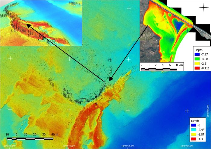
The application of the MBES goes beyond mere structure detection. The system also enables the analysis of microforms of the seabed, such as paleorivers, submerged traces of settlements, former coastlines, and environmental changes related to human activity.
The NCU archaeologists have already planned when and where they will use the sounder. They will begin with pilot and test research at archaeological sites in the region of northern and central Poland, including Lake Lednica. This will allow them to test procedures, calibrate equipment and prepare for full-scale field research. At the same time, they also plan to implement specialised training for team members – both in the operation of the device itself and in advanced data processing.
In the coming months, we plan to use the MBES for preliminary mapping of potential archaeological sites, as well as for cooperation with scientists from the NCU and other research centres and museums. We believe that our new equipment will become not only a research tool, but also a platform for cooperation and exchange of experiences in the archaeological community in Poland and abroad, explains Prof. Pydyn.
Andrzej Romański
The probe will popularise research
It is worth emphasising that the MBES technology is not only a new scientific tool, but also offers enormous opportunities for popularising knowledge. 3D models, interactive bathymetric maps and visualisations of the bottom of water bodies can become excellent educational material. Archaeologists in Toruń already have plans on how to use the collected data, including in museums and activities promoting science.